

")


")

")


")

")


")


Three natural monuments of the Vogelsberg district, two charming hiking trails and the Nidder near Schotten Burkhards and Kaulstoss
The 10-kilometer round trip starts in Burkhards, which not only takes us to three very different natural monuments, but also along the Bonifatius Route and the Vogelsberg Volcanic Ring hiking trail, along the banks of the Nidder River and through a particularly species-rich hedgerow landscape.
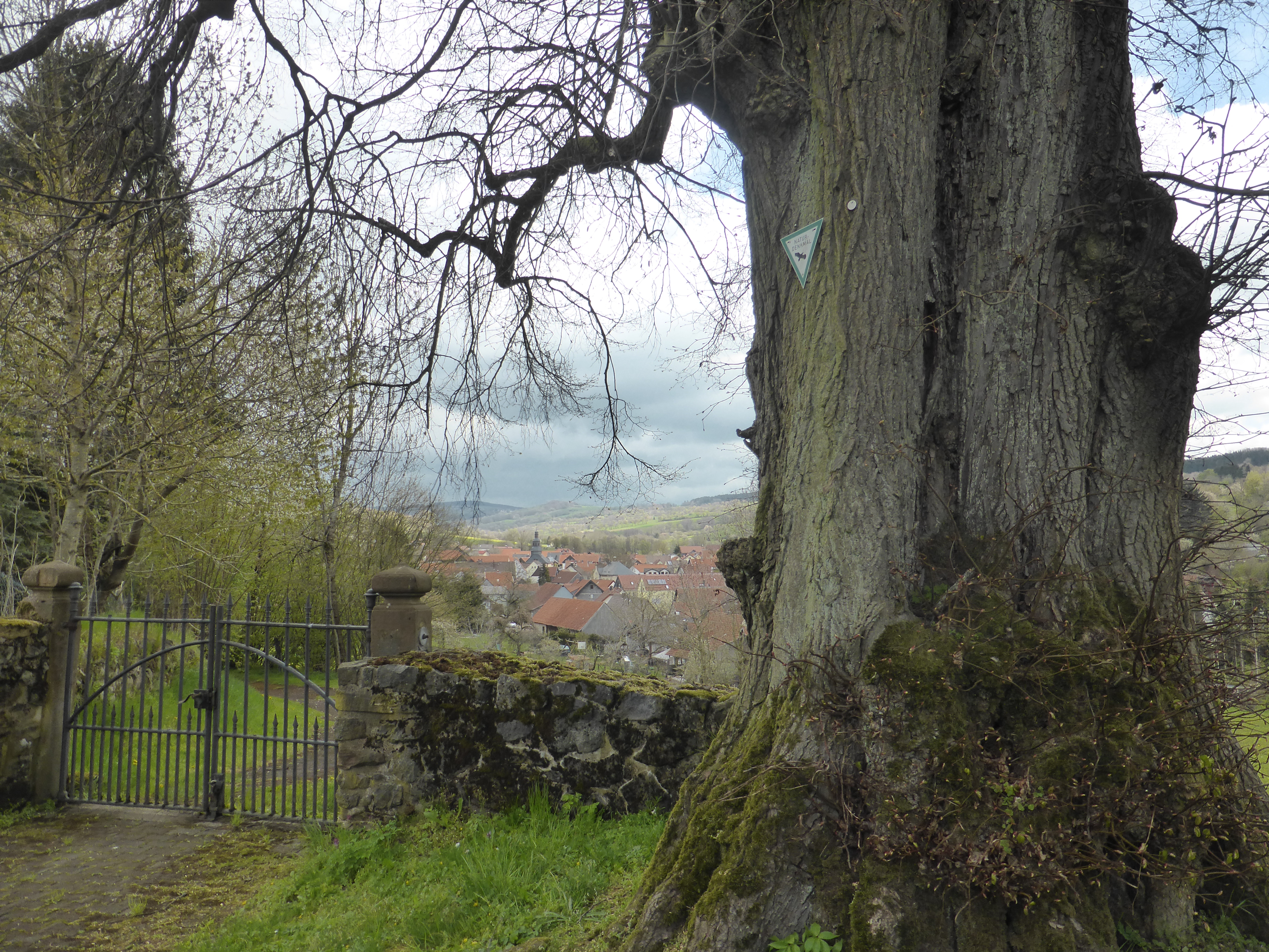
From Burkhards, the four lime trees in the cemetery can be reached quickly via a secluded footpath. This can be found by walking up the Sangenweg (cemetery is signposted) from the main thoroughfare and turning left into a meadow path before the left-hand bend. Through an old basalt dry-stone wall, a wrought-iron gate leads to the mighty natural monuments. Tree 3 is completely hollow and a crown tentile outbreak now gives a view of the sky from below. The somewhat solitary linden tree has a thickness of 6.25 meters and certainly an age of over 300 years.
Worth a look are old tombstones exhibited in the cemetery hall. We leave the graveyard via the upper exit and take the path on the right again in the direction of Burkhards about 100 meters, further up on the left, past a stable.
From the Nidder valley over the south slope it climbs in curves until you reach the Bonifatius route running from west to east. Follow the ridgeway on the right, the old Nidder road, with the signposting Bishop's crozier on a red and white background until after about 1.5 kilometers you arrive at a large 5 star intersection. Here, from the pilgrims' path, turn right down to Kaulstoss, the Hahnlweg. At the bottom of the village, turn left along the main thoroughfare (Nidder road) and immediately right again into Churweg. After a hundred meters you cross the Nidder. Here it is worth taking a look at the old bridges. Maybe you can also see a rare dipper. Now the next ascent follows, this time on the north side of the Nidder slopes. After about 700 meters you should make a small detour so as not to miss the natural monument "Bergsaeckerbuche", turn right off the path onto a small gravel path and after about 100 meters you are already standing under it.
This three-stemmed hute beech is a veteran, but still quite capable of defending itself against fungi of all kinds. If this tree could tell who has all passed by it and how the farmers have struggled for centuries to earn their daily living. The baker's brushwood came from the hedgerows along the roads, near the village lay the fields. Further up, where the soil is even more stony and shallow, grassland, as meadows and pastures. In summer the beech provided shade for the cows and in autumn the pigs were driven under the beeches to fatten, because the beechnuts are very rich in nutrients.
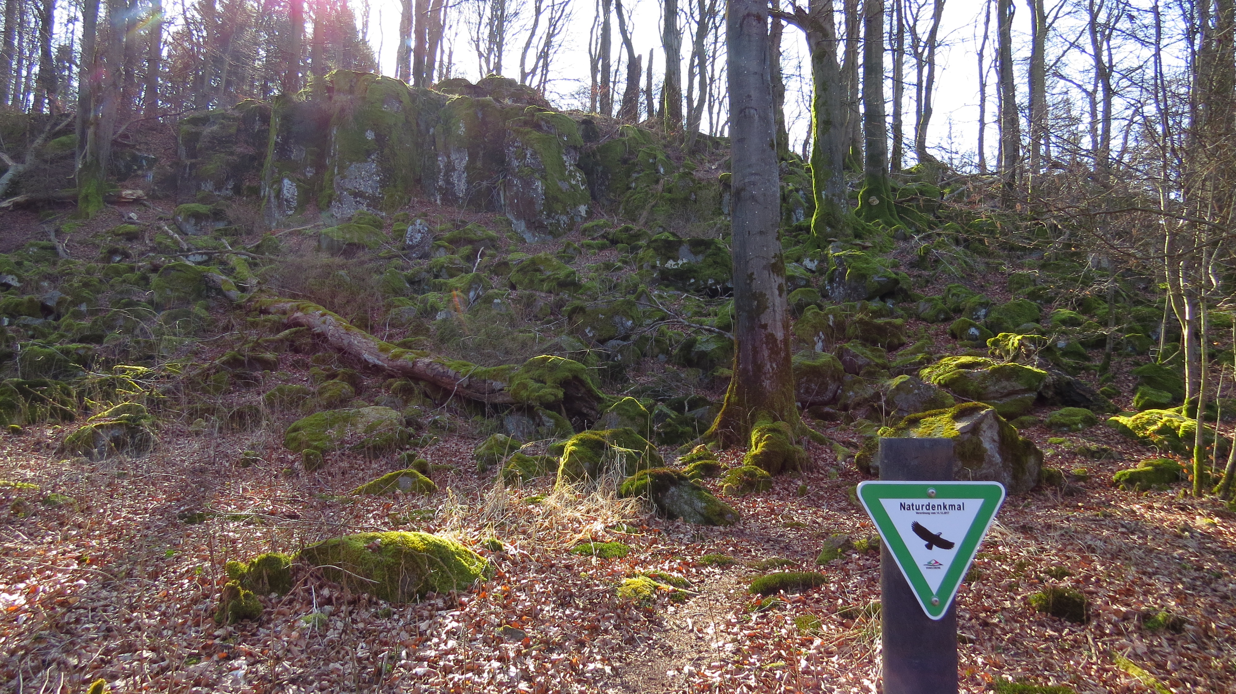
To the left we come back to our path, which leads us uphill to the geotope "Alte Burg", located 600 meters above sea level. After a sharp right turn, you already have a very nice view also of the opposite slope with the path previously covered. Arriving at the forest, you come across the Vulkanring hiking trail (a red and a green V). To get to the impressive rock cliff, follow the certified hiking trail 300 meters to the left. A seating area invites you to take a rest at the remains of this lava flow. A real castle has probably never stood here, but rather this elevated place has served as a refuge. It is not only worthwhile to enjoy the view, but also to find interesting creatures on the mossy rock pile in the near vicinity. The same path leads us back, only do not turn back to Kaulstoss, but follow the volcanic ring to the west on the heights along the forest.
Wonderful views are offered both to the Hoherodskopf, as well as along the Nidder valley. Arriving in Burkhards, we cross the Nidder again and have the opportunity to rest and stop in the two country inns. Recommendation: Beer from the village brewery in Burkhards.