
")


")

")


")

")


")


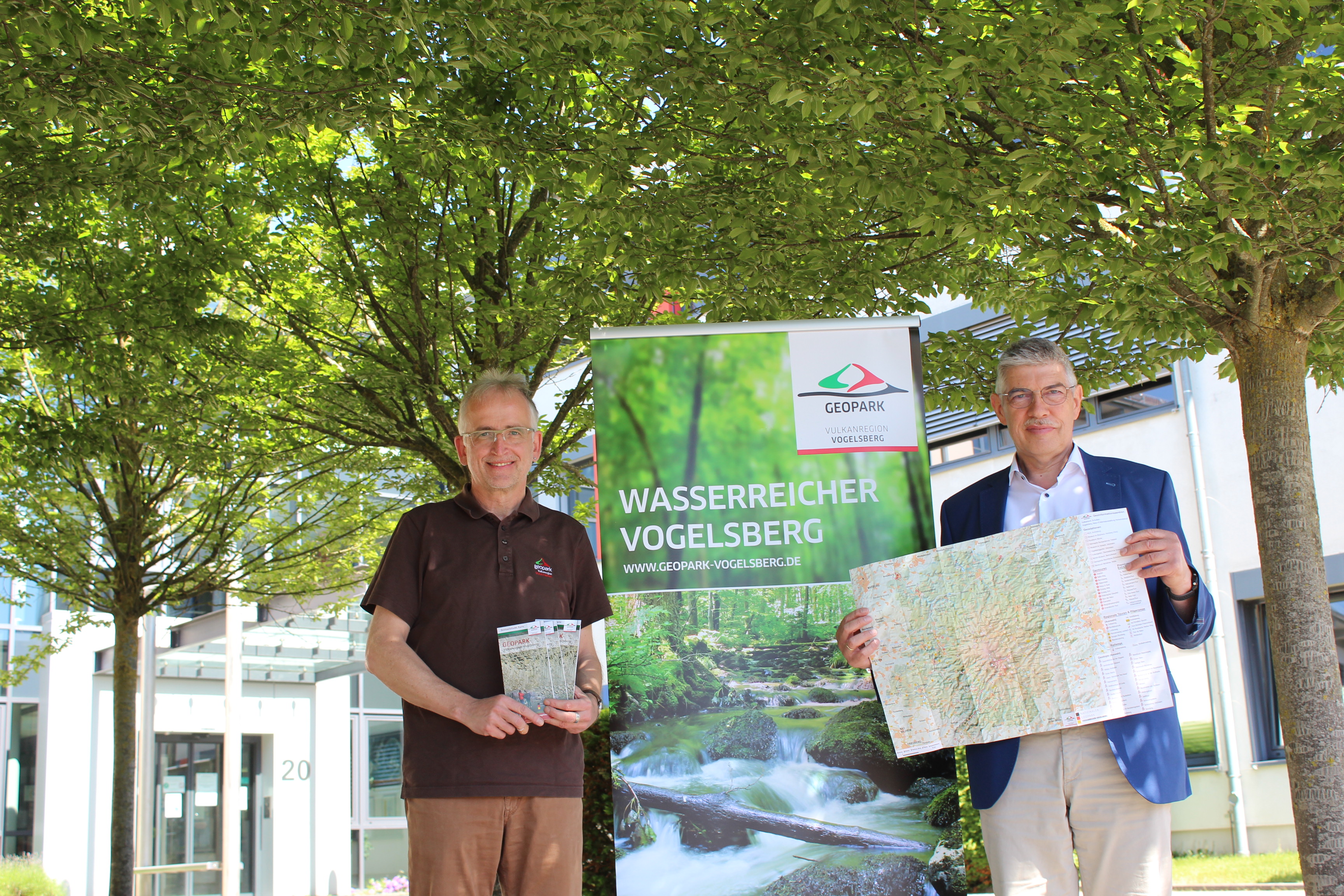
Just in time for the summer season and for tour planning in the local area, it is now available hot off the press: A geotourism map for the Vogelsberg volcanic region that fills a gap for discovering geo adventures in the surrounding area. What are geotopes? Why are they designated as natural monuments? What special geological formations are there in the Vogelsberg that can be visited?
"With the recognition as a National Geopark, we are currently experiencing even greater attention throughout Hesse and on a national level. The map in vest pocket format is therefore a practical addition to our geotourism offerings," says District Administrator Manfred Goerig at the unveiling of the new geopark map.
The map features 30 selected geotopes with exact locations, all of which are examples of the variety of forms and geological diversity in the volcanic region. Not only the volcanoes have left behind mighty rock formations, but also the work of man and the use of raw materials such as the basalt, the lime or the red sandstone created natural jewels and industrial culture. The map presents some of these geotopes with a short explanation. One of the concerns of the Geopark is to make them accessible in a gentle way, but still to ensure their protection. The map is an excellent complement to the tour booklet "Wanderwelt Vogelsberg", since many of the geotopes are located on designated extra tours, bike routes or local hiking trails. Viewpoints, abandoned quarries, ore extraction sites, mystical rocks - the places form backdrops for exciting stories from the modern era, the culture of life or the legends of the Vogelsberg. From Lich to Schlitz, from Birstein to Amoeneburg - the potential of geoexperiences is very broad beyond the borders of the district.
"The Geopark with its geotourism potential does not stop at administrative boundaries, but sees the Vogelsberg in its entirety, which we would like to make known as a sustainable and long-term destination. Volcanoes as a motif for holistic nature experiences are a wonderful backdrop for us, which the earth's history has left for us," continues the district administrator.
Anyone who wants to learn even more about the exciting geo and cultural history is welcome to visit the two geo-information centers Vulkaneum in Schotten and the nature experience exhibition on the Hoherodskopf. Another ten geostations, spread throughout the Vogelsberg, explain special topics that make up the volcanic region. The museum in the brewery in Homberg (Ohm), for example, provides information about the hard work of the stonemasons who produced paving stones for road construction from the surrounding basalt quarries. The geological tree hedge in Schotten-Eichelsachsen, an initiative of the village community and freely accessible, provides insights into the variety of forms of our local rocks, which are literally "at our feet". An ideal place for a short excursion into the geology of the largest volcanic area in Central Europe. Hartmut Greb underlines for the Geopark the enthusiasm for the geotopes in the volcanic region, which are characteristic for the Vogelsberg with their colors, shapes, stories and landmarks: "The map depicts only a small section of the abundance of magical places that the Vogelsberg has to offer. It is intended to be an incentive to engage even more with our natural foundations and their beauty, but also their need for protection."
The map is available in the brochure store of the Vulkanregion Vogelsberg Tourismus GmbH www.vogelsberg-touristik.de or in the Office for Economy and Rural Areas of the Vogelsberg district, reachable by e-mail at wirtschaftsfoerderung@vogelsbergkreis.de. Also in the Lauterbacher district administration and in the geoinfo centers of the Geopark the map is ready for collection.